
|
Easedale
Tarn
|
||
| Type; | Natural | View Larger Map |
| Location; | Grasmere Common | |
| Accessibility; | Access Land | |
| Grid Ref; | NY 307 087 | |
| Elevation; | 282m (925 feet) | |
| Size; | 504m x 282m (1638 x 920 feet) | |
| Area; | 10.6 hectares (26.2 acres) | |
| Depth; | 21m (70 feet) | |
| Meaning of name; | ||
| Alternative name(s); | ||
|
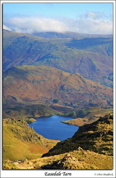
High up on Grasmere Common, Easedale Tarn lies in the amphitheatre formed by Tarn Crag, Slapestone Edge and Blea Crag. Access is via footpath from either Grasmere or Great Langdale. The Grasmere path follows the outfall up to the tarn, passing the waterfalls of Sourmilk Gill. On this first trip I climbed up fom Great Langdale as far as the ridge above the tarns, lack of time precluded going any closer this time. |
||
 |
||
 |
||
 |
||
 |
||
 |
||