|
Wythburn
Head Tarns
|
||
| Type; | Natural | View Larger Map |
| Location; | Wythburn valley | |
| Accessibility; | Access Land | |
| Grid Ref; | NY 304 114 | |
| Elevation; | 406m (1332 feet) | |
| Size; |
very small |
|
| Depth; | 1m (3 feet) | |
| Meaning of name; | tarns at the top of willow tree valley | |
| Alternative name(s); | ||
|
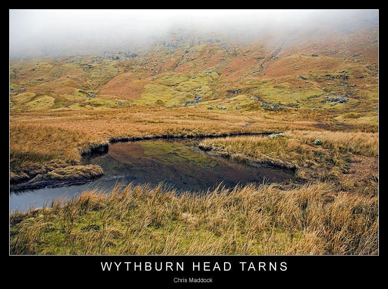
As the Wyth Burn leaves a flat, marshy area named The Bog and its course starts to steepen, it reaches a flat peat-filled bowl retained by a glacial moraine. Where the burn has followed an s-shaped course, the bends have opened out into a number of shallow pools. These collectively are known as the Wythburn Head Tarns. The tarns themselves are not particularly impressive, especially when seen on a dull day like my visit, however the walk up from Steel End passes several pleasing waterfalls as the burn descends between Black Crag and Castle Crag, which are worth a visit in the right conditions.
|
||
|
|
||
|
|
||
|
|
||
|
|
||
|
|
||
|
|
||